Kyiv Fortress

New Pechersk Fortress, Київська фортеця, Kiewer Festung

Schlagwörter:
Fachsicht(en): Kulturlandschaftspflege, Archäologie, Denkmalpflege, Landeskunde, Museen, Architekturgeschichte
Gemeinde(n):
Koordinate WGS84 50° 26′ 3,44″ N: 30° 31′ 37,89″ O 50,43429°N: 30,52719°O
Koordinate UTM 36.324.392,81 m: 5.589.841,01 m
Koordinate Gauss/Krüger 10.537.744,26 m: 5.588.808,79 m
  • Kyiv Fortress from above

    Kyiv Fortress from above

    Copyright-Hinweis:
    Ukrainer.net. © 2020 Ukraine
    Fotograf/Urheber:
    Ukrainer.net. © 2020 Ukraine
    Medientyp:
    Video
    Anklicken öffnet eine größere Vorschau in Galerieansicht
  • Kyiv Fortress in August 2009

    Kyiv Fortress in August 2009

    Copyright-Hinweis:
    Turzh, Igor
    Fotograf/Urheber:
    Igor Turzh
    Medientyp:
    Bild
    Anklicken öffnet eine größere Vorschau in Galerieansicht
  • Kyiv Fortress in the center of a map showing Kyiv in the 1830s

    Kyiv Fortress in the center of a map showing Kyiv in the 1830s

    Copyright-Hinweis:
    Urheber unbekannt / public domain
    Fotograf/Urheber:
    unknown
    Medientyp:
    Bild
    Anklicken öffnet eine größere Vorschau in Galerieansicht
The Kyiv Fortress or New Pechersk Fortress is located in Pechersk, Kyiv, Naddniprianshchyna. It is the largest monument of military construction in the first half of the 19th century in Ukraine. In addition, it is one of the world's largest surviving stone and earth fortresses.

Historical background and structure
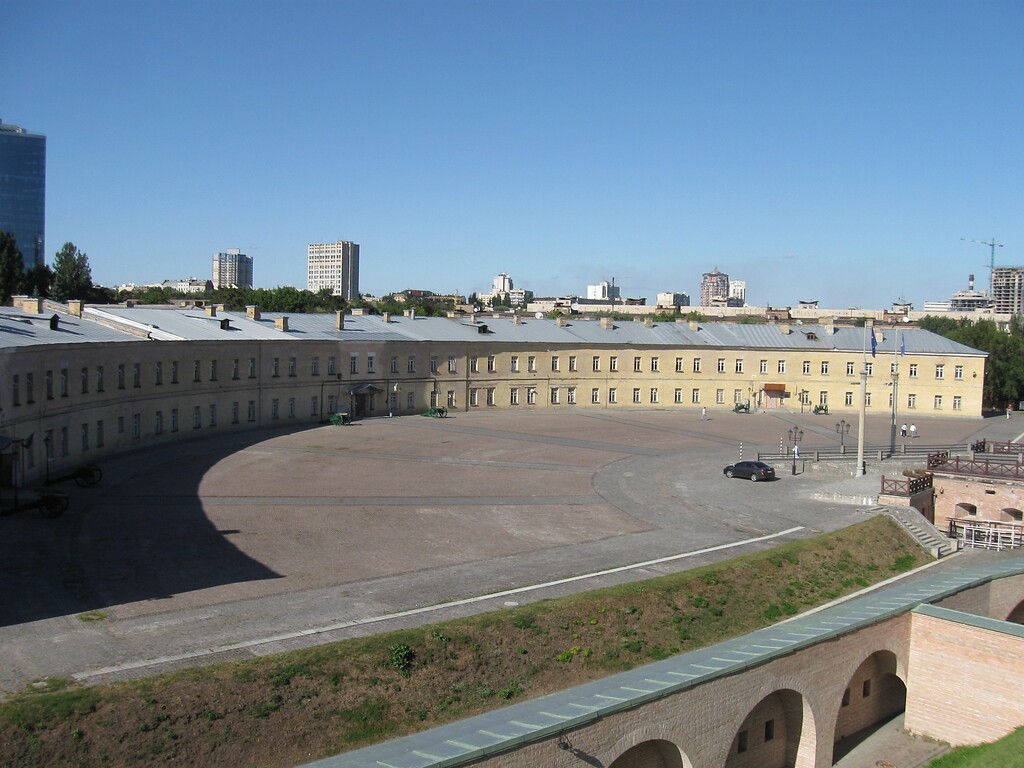
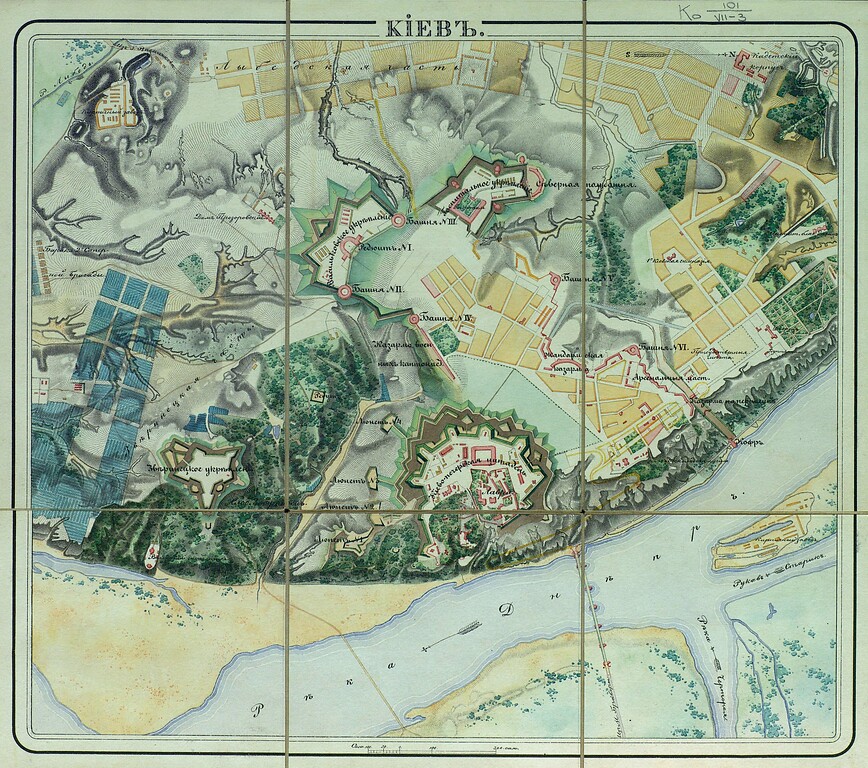
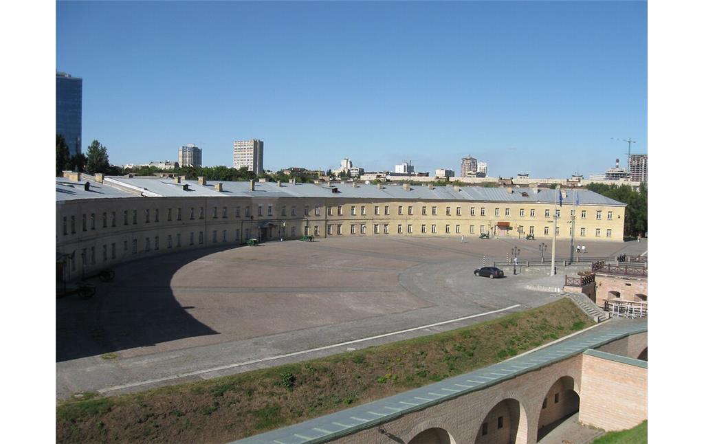
Kyiv Fortress is a complex of structures built in the 1830-1860. Its foundation was initiated by Nicholas I (1796-1855), since the Starokyivska (Old Pecherska) fortress at that time was outdated and no longer performed a defensive function. The project was developed by Karl Opperman (1766-1831), a German-born engineer, surveyor, army officer and fortification builder in the service of the Imperial Russian Army. The structure of the Kyiv fortress includes earthen fortifications, defensive walls, Hospitalne and Vasylkivske fortifications and brick casemates. The fortress was so great that some of the inhabitants of the Pechersk region were relocated to the valley of the Lybid River, where a new district of the city was formed.

Today’s use in tourism
Most of the fortifications are preserved to this day. The fortress is a historical and architectural museum complex based on the Hospitalne fortification. It includes, in particular, a number of museums, an exposition with defensive ramparts in the open air, a fortress wall and caponiers. In some buildings, units of the Armed Forces of Ukraine are located, as well as the Main Military Clinical Hospital. Exhibitions, theater performances, conferences and other events are held on the territory of the fortress.

(Maryana Senkiv, ukrainer.net & Lviv Polytechnic National University, 2021; Special thanks to ukrainer.net))

Internet sources:

de.wikipedia.org: Kiewer Festung
en.wikipedia.org: Karl Oppermann
en.wikipedia.org: Kyiv Fortress
kyiv-fort.org.ua: Київська фортеця
new.pamyatky.kiev.ua: Structure of Kyiv Fortress
uk.wikipedia.org: Київська фортеця

Kyiv Fortress

Schlagwörter
Straße / Hausnummer
Prov. Laboratornyy
Ort
01133 Kyiv
Gesetzlich geschütztes Kulturdenkmal
Kein
Fachsicht(en)
Kulturlandschaftspflege, Archäologie, Denkmalpflege, Landeskunde, Museen, Architekturgeschichte
Erfassungsmaßstab
i.d.R. 1:5.000 (größer als 1:20.000)
Erfassungsmethode
Literaturauswertung, Fernerkundung
Historischer Zeitraum
Beginn 1830 bis 1860

Empfohlene Zitierweise

Urheberrechtlicher Hinweis
Der hier präsentierte Inhalt ist urheberrechtlich geschützt. Die angezeigten Medien unterliegen möglicherweise zusätzlichen urheberrechtlichen Bedingungen, die an diesen ausgewiesen sind.
Empfohlene Zitierweise
„Kyiv Fortress”. In: KuLaDig, Kultur.Landschaft.Digital. URL: https://www.kuladig.de/Objektansicht/KLD-330527 (Abgerufen: 27. Juli 2024)
Seitenanfang